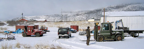
ice2ice scientists from NBI are involved in two ice coring campaigns this year; the ReCAP project and the NEEM to EastGRIP traverse. The first people flew into Kangerlussuaq, East Greenland on Monday the 20th. More will follow tomorrow; Friday 24th April-2015. The last people will leave Greenland the 3rd of July.
The ReCAP project
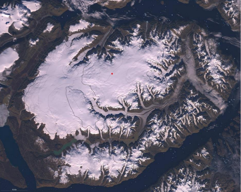
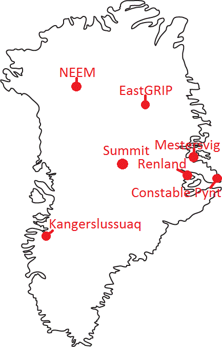
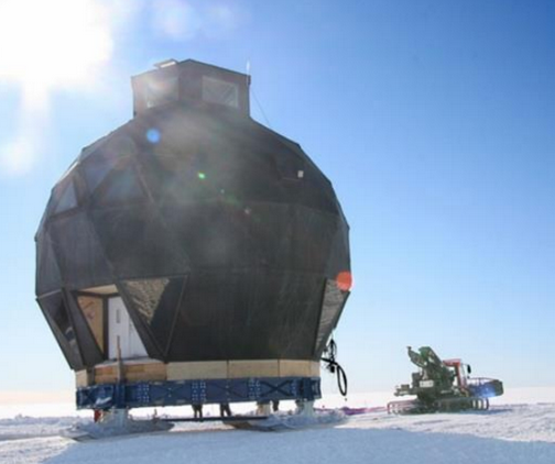
The Renland ice cap is situated in Eastern Greenland on a high elevation plateau on the Renland peninsula in the Scoresbysund fjord (see Figure). Climatic conditions on the Renland ice cap are strongly influenced by the varying Arctic sea ice export along Greenland’s east coast. An ice core from the Renland ice cap is thus perfectly suited for obtaining information on Eastern Greenland climatic conditions including the export of sea ice from the Arctic Ocean for the past 100,000 years. We therefore propose the REnland ice CAP project (RECAP).
The overall purpose is to support a drilling to bedrock on Renland ice cap (to approx. 500 m depth), to support basic ice core processing on site, to support a firn air pumping and shallow ice coring operation, to support a pre-site radar survey and to support testing of new ice drilling technologies. These activities require a field camp with 11 persons over a period of 2 months. Renland ice cap is not easily accessible. LC-130 cannot land on this small ice cap so the bulk of the air lift to the ice cap occurs through a collaboration with German Alfred Wegener Institute (AWI) who have put a Basler ski-equipped air craft to the disposition of RECAP in three periods (around put-in, around mid-season crew exchange and around the pull-out). The Basler will operate out of the civilian airport of Constable Pynt (Nerlerit Inaat or CNP), which is the airport of Scoresbysund (Itoqqortormiit) and Mestersvig (MST), which is an abandoned mining town, now operated by the Danish military in the NE-Greenland National Park.
The ReCAP project is split into three phases:
- Late April to early May: Radar measurements with CRESIS surface radar, establish skiway (4 crew).
- Early May to end of May: Establish main camp, deep drilling an ice core to bedrock and firn gas project (11 crew).
- Beginning of June to late June: Continuing the deep drilling, testing rapid access drill and take down camp (11 crew).
The logistic operations in RECAP will follow these steps:
- Two persons deploy to Constable Pynt by commercial plane to unpack cargo there and make it ready for shipment.
- The rest of the put-in crew and East coast FOM will fly to Mestersvig by 109th C-130 along with cargo (tents, weatherports, drills, food, etc.).
- A group of four persons will fly to Renland Ice cap (either by helicopter or Twin Otter) for site survey using Kansas radar. In about three days the optimal drilling site should be identified and camp put-in can occur using the Basler from both Constable Pynt and Mestersvig. Two radar operators return to Constable Pynt. At Mestersvig a freezer will be built to keep ice cores from Renland cold.
- RECAP camp construction will progress while the Basler finishes deployment of people and equipment.
- Drilling processing and sampling and firn air program.
- Mid-season crew exchange will occur by Basler to Constable Pynt.
- Drilling processing and sampling and rapid access drill test.
- During pull-out, the Basler will shuttle cargo to Constable Pyntfor stowing into containers bound for Kangerlussuaq and passengers, ice cores and other equipment to Mestersvig.
- Passengers, ice cores, and all equipment in Mestersvig is picked up by C-130 in two (possibly three) C-130 flights to Kangerlussuaq.
Follow diaries from the ReCAP project here.
NEEM to EastGRIP traverse
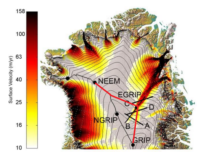
In North East Greenland, the biggest ice stream in Greenland begins right at the central ice divide and cuts through the ice sheet in a wedge shape to feed into the ocean through three large ice streams (Nioghalvfjerds isstrømmen, Zachariae isbræ and Storstrømmen). The onset of the ice stream on the ice divide is believed to be caused by strong melting at the base and the ice reaches velocities over 100 m/yr 200 km from the ice divide, but still 500 km from the coast where the ice is heavily crevassed. Center for Ice and Climate , NBI, University of Copenhagen have been granted money to do a large drilling at this exciting site.
This May all the equipment must be pulled to EGRIP and the main purpose for this years field campaign on the central ice sheet is to move the equipment. Currently the main part of the equipment needed to establish the camp at EastGRIP is stored at the previous deep drilling site NEEM, 380 km West-Northwest of EGRIP. The main building, the Dome was put on skis in 2011 to enable surface transport to the new site. All the remaining equipment is stored on sledges at NEEM.
The Traverse will thus start at the NEEM ice core site at move the 380 km to the North west of Greenland. Part of the group will further continue up to the American ice core camp Summit.
During the traverse as much science as possible will be performed including:
- Deep borehole logging at NEEM
- Strain net and GPS measurements to determine ice flow
- Radar measurements to follow layers between NEEM, EastGRIP and Summit
- Drilling of 5 shallow cores to investigate anthropogenic impact in the far north and resolve the impact of sea ice on impurities and water isotopes.
Follow diaries from the Traverse here.